Where the UCSB Beach Sand Comes From
 |
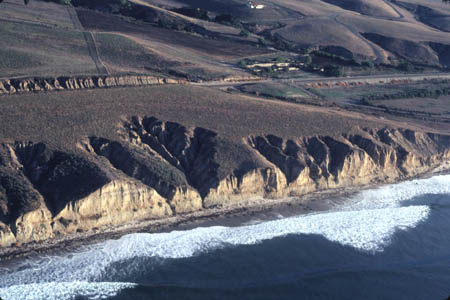
| Oblique aerial view northeast of beach cliffs, El Capitan Ranch, Santa Barbara County, December 1979. Almost all sand for UCSB beaches is transported by intermittent streamflow from the mountains in the background directly to the beach. Most of the sand for the beach is transported down canyons in big, intermittent floods. Some of the sand may be temporarily trapped in terraces - the flat area between the coast and the highway - and eroded later both by waves and streams. The ragged notches in the cliff indicate where stream erosion has carried away the sand stored in the terrace to the sea for transport to UCSB by longshore currents. The steepness of the cliffs indicates the vigorous attack of the waves on the cliffs. The longshore current is from left to right in the photo, as indicated by the oblique angle of the wave fronts tto the shore line. Virtually no sand passes around points Arguello and Conception from the north to the south coast beaches. ©AGS1979 |
 |
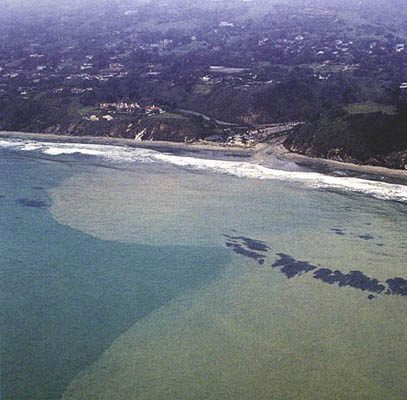
| After rainstorms, creeks carry sediment to the shore. Fine-grained sediment (silt) is carried out to sea beyond the surf zone, whereas coarser-grained sediment (sand and pebbles) is deposited at the beach where is it reworked and redistributed by waves and longshore currents. Here in this aerial view, Arroyo Burro Creek, Santa Barbara, sends a plume of sediment (tan) to the beach and sea after a heavy rainstorm. Photo ©2001 Jeff Jones, Marine Science Institute, reproduced here by permission. |