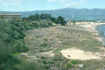
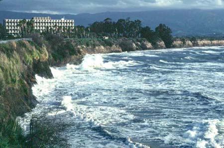
View north of UCSB beach, an arcuate, east-facing beach on the east edge of the campus and on the west edge of Goleta Bay. Each image was taken from the same place - at the top of the beach access steps across Lagoon Road from Anacapa dormitory on the UCSB campus. Longshore drift is from the bottom of the page toward the top. Notice the heavy growth of vegetation on the beach, and on and along the cliff in 1975. The beach was so stable then that a volleyball court was erected together with a concrete ring BBQ pit. The vegetation and sand protected the cliff from direct attack by ocean waves. In the lower image, however, the vegetation and sand have been removed, and the waves are attacking the cliffs directly during a powerful storm. The cliffs are black in the foreground because they are wet. They are brown in the background where drier. ©AGS1983
The sand for the wide beach in the 1970s is probably the result of erosional flush by the 1969 El Niño of accumulated rock bared by the 1955 Refugio fire that burned from San Marcos Pass to Pt. Conception (Inman & Jenkins, 1999).